
Cartografia Oficial
Publicado a 18/03/2014 e Revisto a 28/01/2026
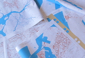
Mapas com Cartografia Oficial à escala 1: 10 000
Aqui encontra mapas com a cartografia oficial e vetorial topográfica à escala 1:10 000, de âmbito regional e municipal, disponíveis ao público para visualização. Neste conjunto encontram-se vários temas da Cartografia da Região, tais como, Altimetria, Áreas Agrícolas e Florestais, Áreas de Recreio e Lazer, Áreas Industriais e Serviços, Construções, Transporte e Abastecimento, Hidrografia e Rede Viária.
Caso pretenda adquirir a Cartografia referente ao ano 2000, por favor, preencha o seguinte formulário e envie-nos por email (geral@regiaodeaveiro.pt):
Nota sobre a cartografia disponível na Região de Aveiro: O formato dos ficheiros vetoriais é DGN versão 7, multicodificado segundo as especificações técnicas da Direção-Geral do Território que podem ser consultadas aqui. O ano de referência dos trabalhos é 1999/2000, à escala 1:10 000, no sistema de referência Hayford-Gauss Datum 73, Sistema Altimétrico de Cascais apenas para os seguintes 6 Municípios: Aveiro, Estarreja, Ílhavo, Murtosa, Ovar e Vagos.
Outras entidades com Cartografia Oficial
Hiperligações a entidades Portuguesas Oficiais que disponibilizam produtos geográficos em várias escalas (cartografia, fotografia aérea, etc.):
– Para ver os produtos disponíveis consulte a seguinte página: https://www.igeoe.pt/index.php?id=6
– Para ver os produtos disponíveis consulte a seguinte página: http://www.hidrografico.pt/produtos.php
Outras entidades com Cartografia Temática
Hiperligações a outras entidades Portuguesas que disponibilizam cartografia temática:
- Agência Portuguesa do Ambiente (APA)
- Instituto da Conservação da Natureza e das Florestas (ICNF)
- Laboratório Nacional de Energia e Geologia (LNEG)
Serviços Web Nacionais
Hiperligações a listas de serviços web (web services) de âmbito Nacional:
- Serviços Web da DGT: https://www.dgterritorio.gov.pt/dados-abertos
- Serviços Web do IGeoE: https://www.igeoe.pt/index.php?id=47
Cartografia Gratuita Open Street Map
Hiperligação para OpenStreetMap:
- OpenStreetMap: OpenStreetMap for Portugal
Metadados dos mapas da Região de Aveiro aqui: Metadados
Esperamos que estes mapas sejam uma ferramenta útil para encontrar o que procura, enquanto explora a informação disponível sobre a Região.
Se não encontrou o que procura, envie-nos um email (geral@regiaodeaveiro.pt) com os aspetos que gostaria de ver publicados.
Etiquetas: 10000, 10k, cartografia, escala, homologada, oficial, sig, temática, topográfica, wms


NIF 508 771 935 | tel +351 234 377 650 | tlm +351 937 084 680 | fax +351 234 377 659 | e-mail geral@regiaodeaveiro.pt